
I’m clinging to a sandstone fin, a hundred feet above Coyote Gulch. Stuck. Can’t go up, can’t go down, should be able to creep sideways, but that would involve looking down, and I don’t think that’s a good idea.
Well.
Luckily – as usual – my husband comes to the rescue. Mountain Goat Bill climbs to the little ledge above me, is able to give me a hand, and I’m unstuck.
I’ve since read that this climb is what’s known as a Class 3 Scramble, which means that you probably won’t die if you fall, but you would likely “sustain severe bodily injury.”
Jeez.
Here’s a photo of the fin, but I don’t think it shows how scary the climb is for us non-climbers:

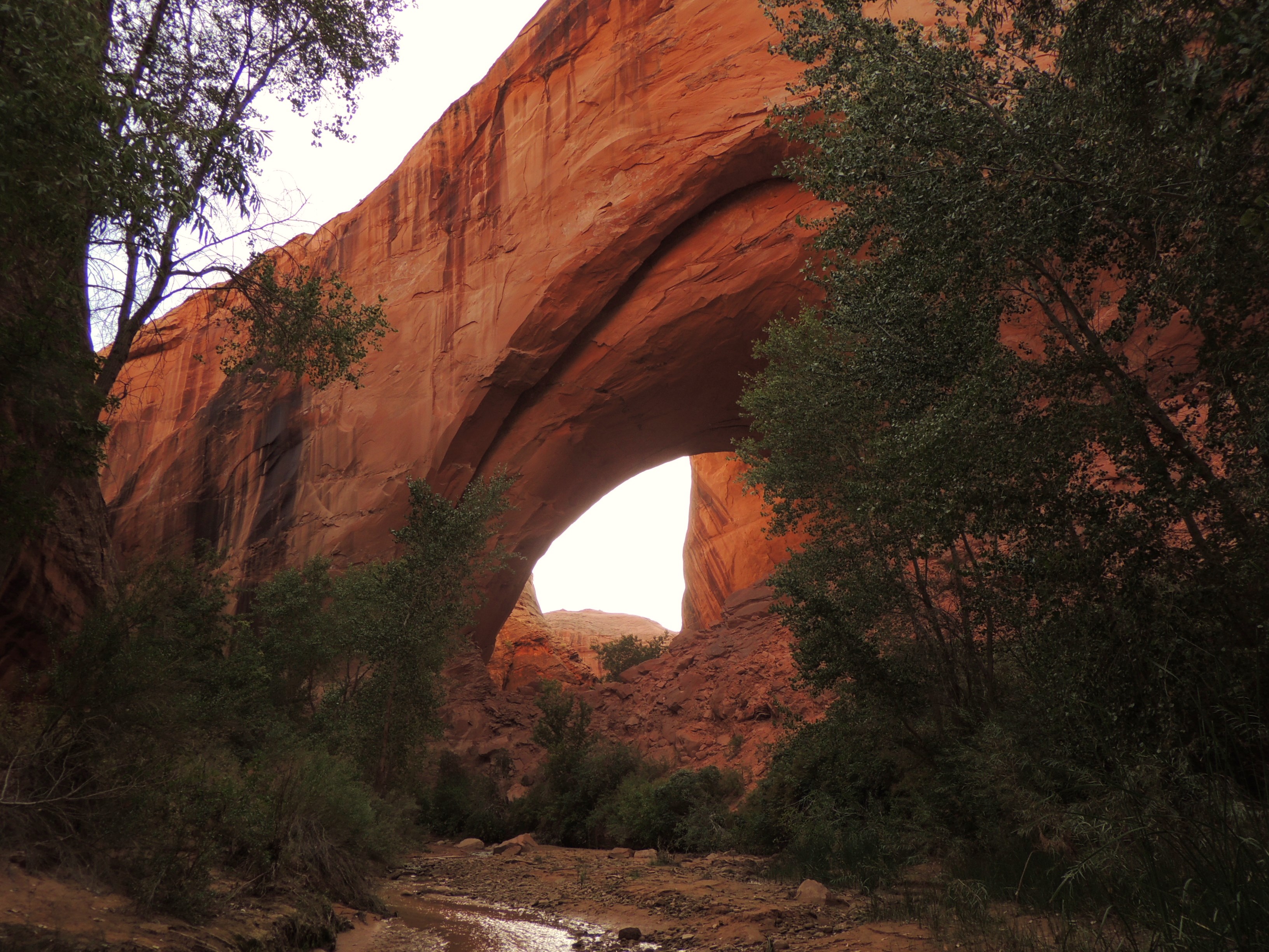
Looking down from the Jacob Hamblin Arch exit from Coyote Gulch.
I did find a great blog (Canyoneering.Wordpress.com) that includes a much better photo. Here’s the link:
Great photo of the climb out of Coyote Gulch from Jacob Hamblin Arch.
See? Scary.
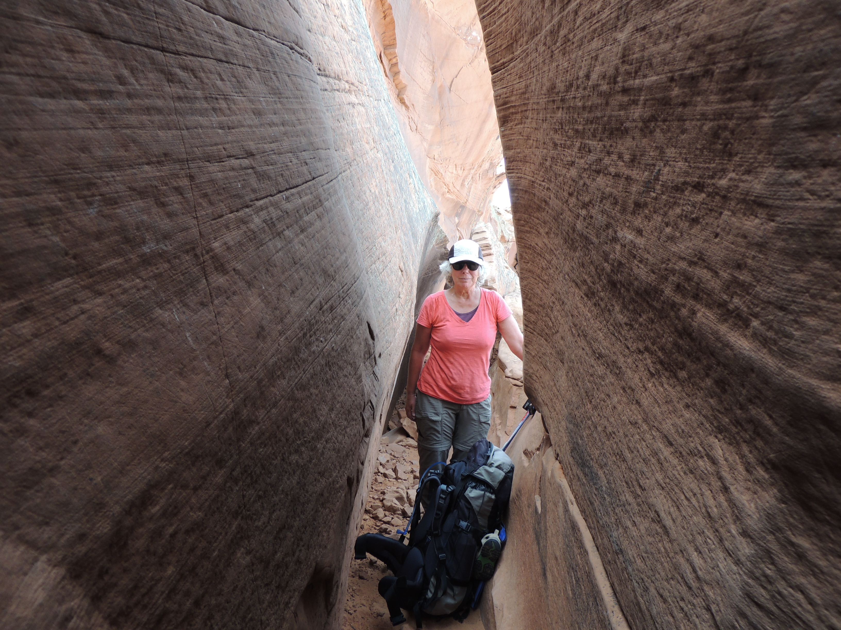
Of course, there’s more to Coyote Gulch than just a few scary moments. We’d been before, entering and exiting through Hurricane Wash, but this time we wanted to do a loop, and that meant entering through the “Crack in the Wall” which puts you almost at the confluence with the Escalante River.

Bill checking out our route at the Crack in the Wall.
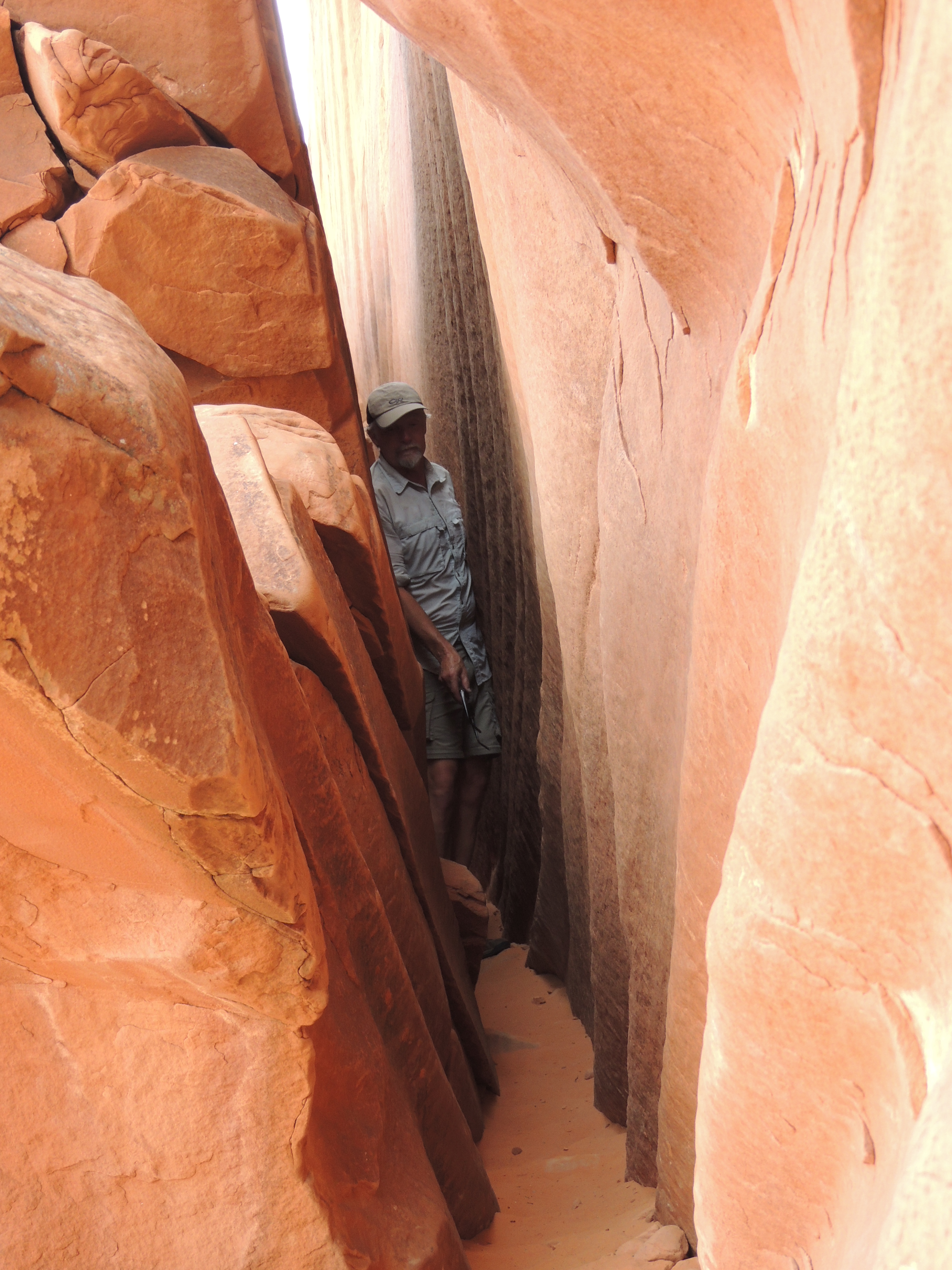
The Crack in the Wall is an adventure in itself. The crack is really three “cracks” made up of three huge slabs of sandstone that have broken away from the cliff face. It’s a two mile hike across the mesa top to get to the cliff, and then you need to drop down about 8 feet into the narrow first crack. Dropping into a crack in the earth: not something I’m overly fond of. Luckily, the first crack is not too long, and it’s the widest, so it’s really not that hard.
I’m not looking too thrilled, am I?
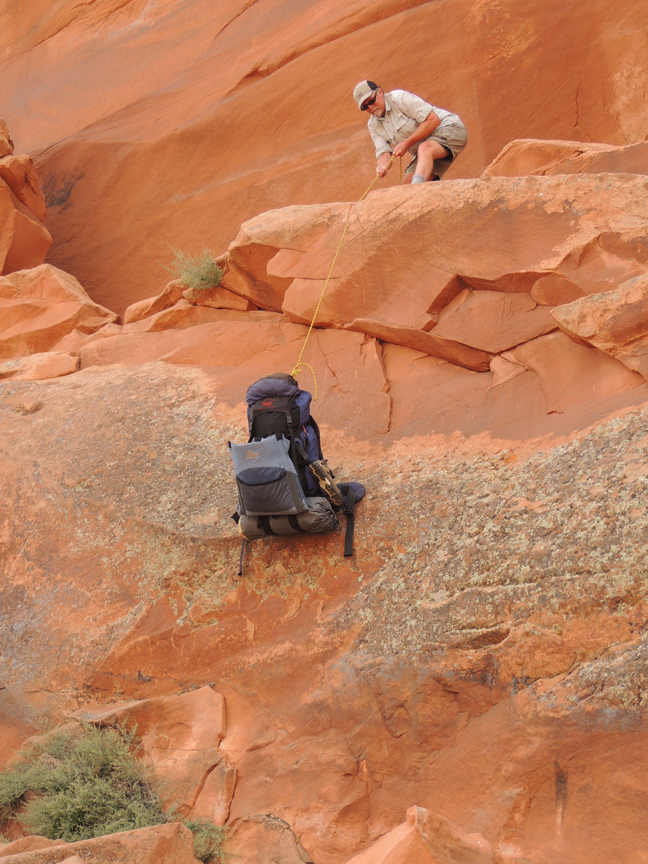
The second crack is pretty easy, too. The third one, however, is really narrow, which means backpacks usually can’t fit through. Luckily there’s a ledge in between the cracks so you can lower your backpacks down before you squeeze your way through.
Once through the cracks, you hike down a huge sand dune to the gulch. This long dune is the main reason you don’t want to do this hike in the opposite direction. (Coming down the scary fin is another: always scarier to come down a steep slope than to go up it!)
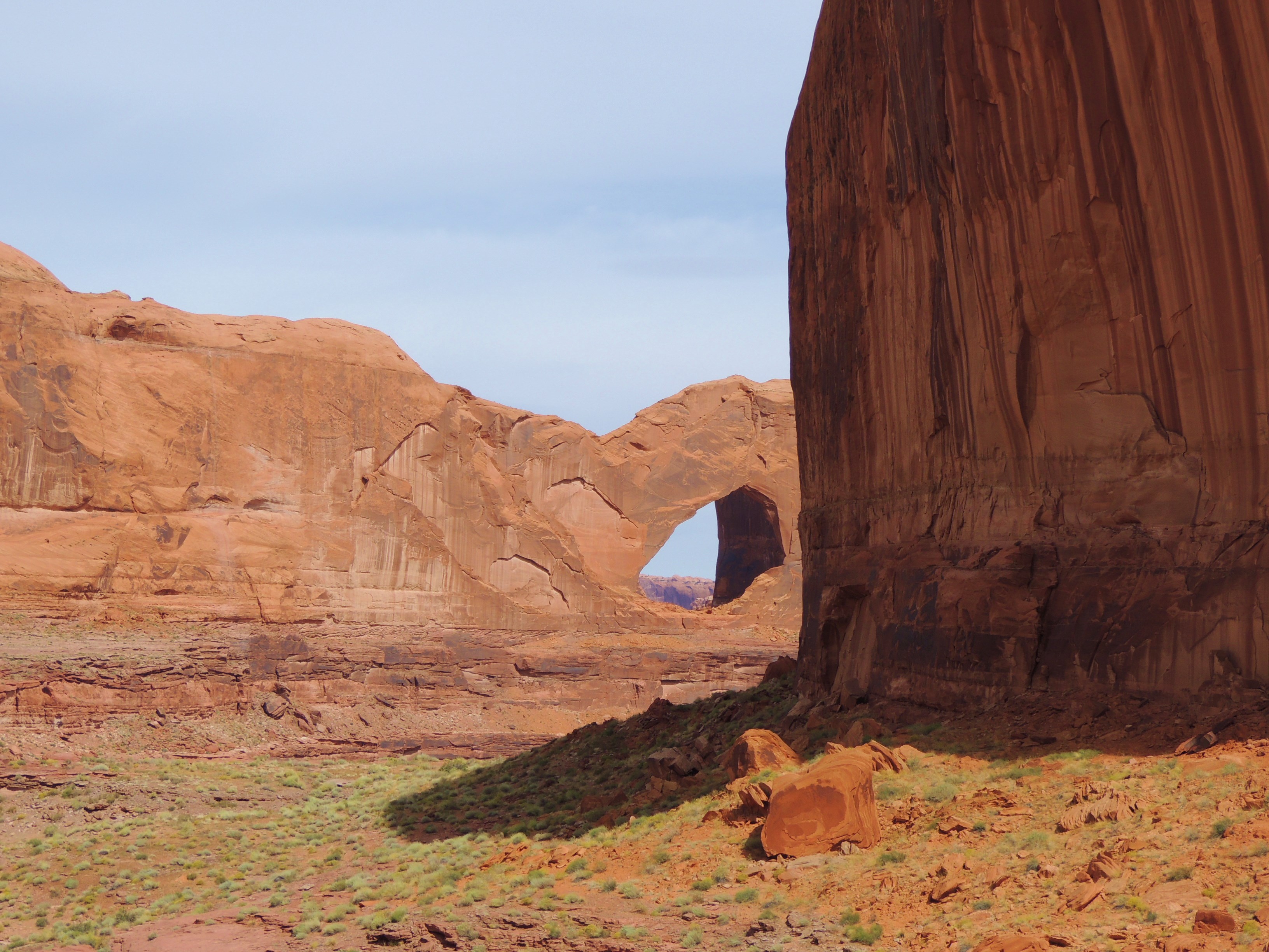
You get a great view of Stevens Arch on the way down.
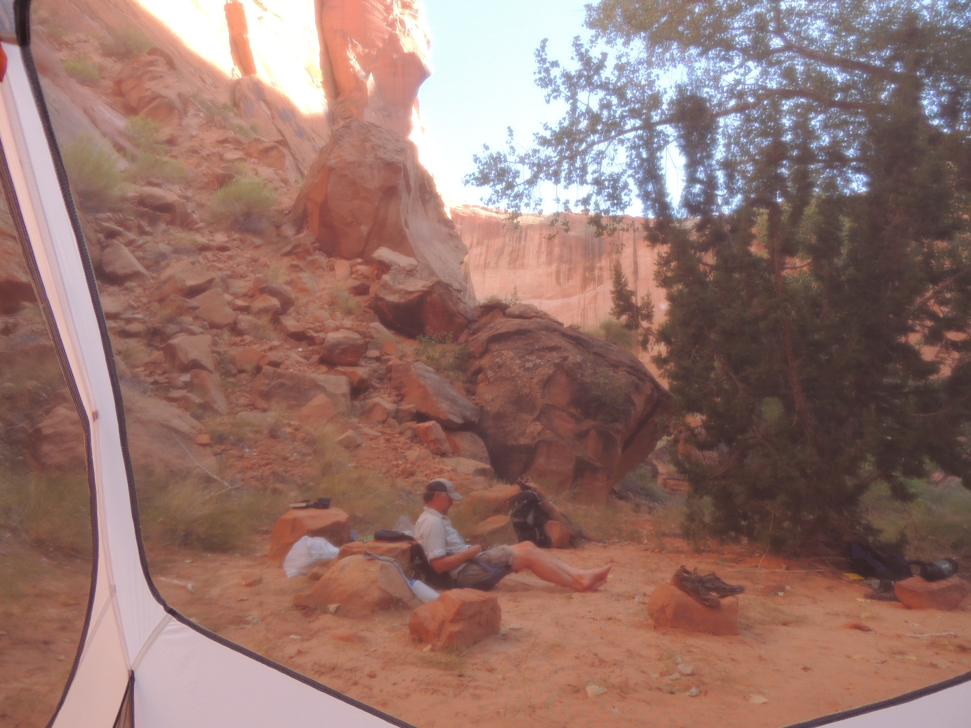
We camped not far after we’d entered Coyote Gulch. A lot of folks seem to do this hike in one night, but I think at least two is better. There’s a lot to see down there. The campsite is just downstream from a nice spring, and it’s one of the best in the gulch. My coffee cup gave it a thumbs up.


The next day we hiked up the gulch, exporing along the way. There are pictographs to be found, but we’ve missed them both times. Next time.


We camped near Jacob Hamblin Arch, which is the focal point of the gulch. It’s an incredible sight: massive and brooding. There’s even a lovely year-round spring near the arch, so it’s a great place to camp. Of course, we’re not the only ones to think that, so you’ll rarely have it to yourself. But still.


If I hadn’t been so nervous about the impending climb out, I would have liked to stay another day and do a bit more exploring. But hanging around waiting to be scared doesn’t work too well for me. So the third morning we started up. The first twenty feet of the climb is pretty much straight up, but there are some good foot and hand holds, so that wasn’t too difficult for me. The next hundred feet is pretty much straight up a steep slickrock slope. You can get a good grip on slickrock, but there are still a few places where you need to pull yourself up and over. There is an anchor at the top where you could tie a rope, and it probably would have been wise for us to do that: I could have used it to help me get over those few extra steep spots. Oh, and it absolutely helped to have my sherpa-husband who actually climbed the route three times: once without a pack to lead me up, and two more times with each of our packs!
Hooray for a brave and strong partner!


That looks like it was a great adventure by the wonderful photos and story. Would you do it again?
I would, but I’d send Bill up with a rope first, and then it would be pretty easy!
What an adventure! Looks like a lovely place to visit and camp awhile, but I’m not too sure about the tight spots you negotiated to get there…
Wonderful photographs!
Thanks! I just read a post by a guy who was too big to get through the third crack, so he had to go on the outside. Holy crow!
A great story and photographs of a daring adventure. Looks like a challenge and you must have felt wonderful when you completed it. Good on you!
It did feel pretty good to do something I was scared to do, that’s for sure. Thanks!
oooh, i am so jealous! (not about the scared parts, i would be too!). thanks for sharing!
And thanks for checking it out!
Wow, I’m sure there were some nerve racking moments but the stunning scenery must have been so rewarding!
It was. Definitely need some sort of incentive to get out of my comfort zone, and stunning scenery is a good one!
Beautiful photos as always. Thanks for the sun, it’s been pretty foggy in my neighborhood lately.
There really is nothing like that bright sun and red rocks. Although I imagine if I lived there I would be longing for some foggy days! Thanks.
What a beautiful place.
And not too far from you, either!
Stunning! It pays to be brave!! Your photos really capture the beauty and challenge of this hike. Thanks for doing this so the rest of us can enjoy it 🙂
Nice. Thanks.
Good grief. Makes me glad I live in a place with maximum elevation 350 feet — except that those views are spectacular. Nothing like that here. The sandstone is unbelievably red!
:). You know, I always feel vaguely claustrophobic whenever I’m in Massachusetts – I must need to see over the trees!
Great hike/climb!
🙂
Wow – what an amazing scenery! I would love to do some hiking here. But I would tend to agree with you, that scramble looks a bit scary too me! 🙂
You can skip the scary part and still get the gorgeous scenery! I highly recommend it. Thanks!
I am glad to hear it. I will give it a chance:)
Looks like an amazing place to explore! Thanks for sharing your adventure, and suitably impressive photos 🙂 Leah
And thanks for checking it out!
I tried to climb up via that stupid steep slope, and not being a very good climber, I ended up slipping, then sliding about 15 feet (seemed like much more!) back down on my belly, scraping my hands and knees and camera up pretty good. After that, I refused to try again! We ended up walking up canyon to the Hurricane Wash trailhead, where my buddy hitched a ride back to the truck at the 40-mile Ridge trailhead. Meanwhile, I sat in the shade, had a ranger come by and check on me – turned out he had heard about “the guy who slid back down”. Oh, great, I’m famous for being a bad climber! Still, I would go back and backpack it again – need to go see Steven’s Arch up closer and find that rock art.
Scary! Sliding 15 feet would feel like you were going forever!
Yeah, it WAS scary…i just laid there for a few minutes without moving…asking my hiking buddy “am I going to go over the edge?” There was a steeper section just below me. No more climbing attempts without rope for me!
Just did this trip with group of friends. Crack in the wall was easy. The scramble out of Hamblin Arch was truly scary for some, but a great couple from Mexico left some webbing 160 ft worth that we used as climbing rope to pull us up. Without we believe we wouldn’t have been able to climb it. It’s a true class 3. Once we got to the top we followed the cairns but I also took a bearing on my compass towards the place where we parked 40 mile ridge without it would have been tough to navigate as the cross hike in sand proved challenging if it weren’t for me knowing map n compass through scout ing & REI class I took. It can be disorienting as you can spot the tanks parking easier, but 40 mile isn’t visible till your within 1/4 mile of it. Amazing place!