
It’s about a 10 mile roundtrip hike across Cedar Mesa, down into Grand Gulch, and up the gulch to the spectacular Big Man Pictographs. We’ve done it as a day trip, but it’s worth spending as much time as you can exploring Grand Gulch. We only had one extra night on our recent trip, so we decided to hike the three miles across the mesa and find a camp near the rim of the gulch so that we could spend more time exploring the canyon without heavy packs.
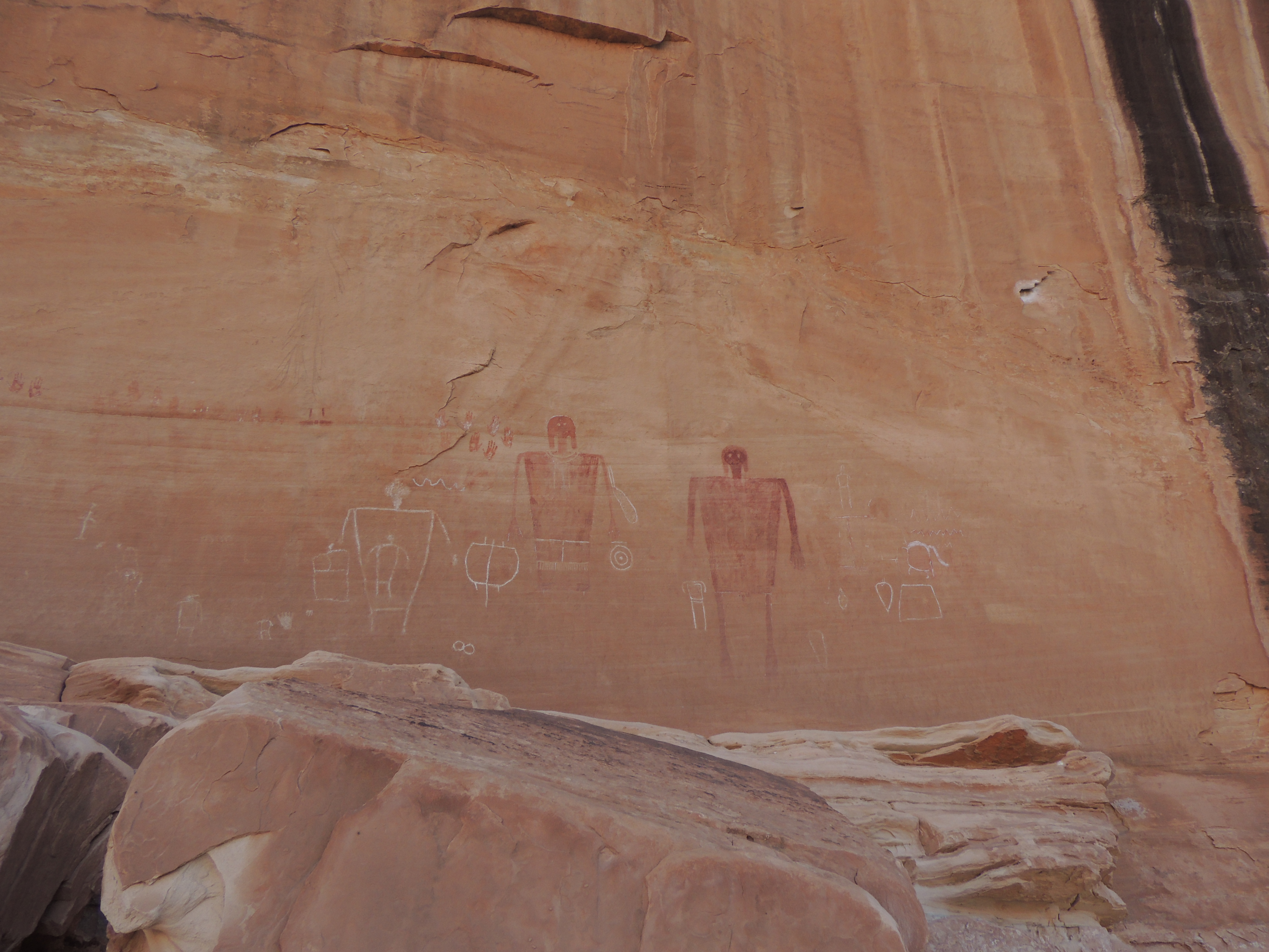
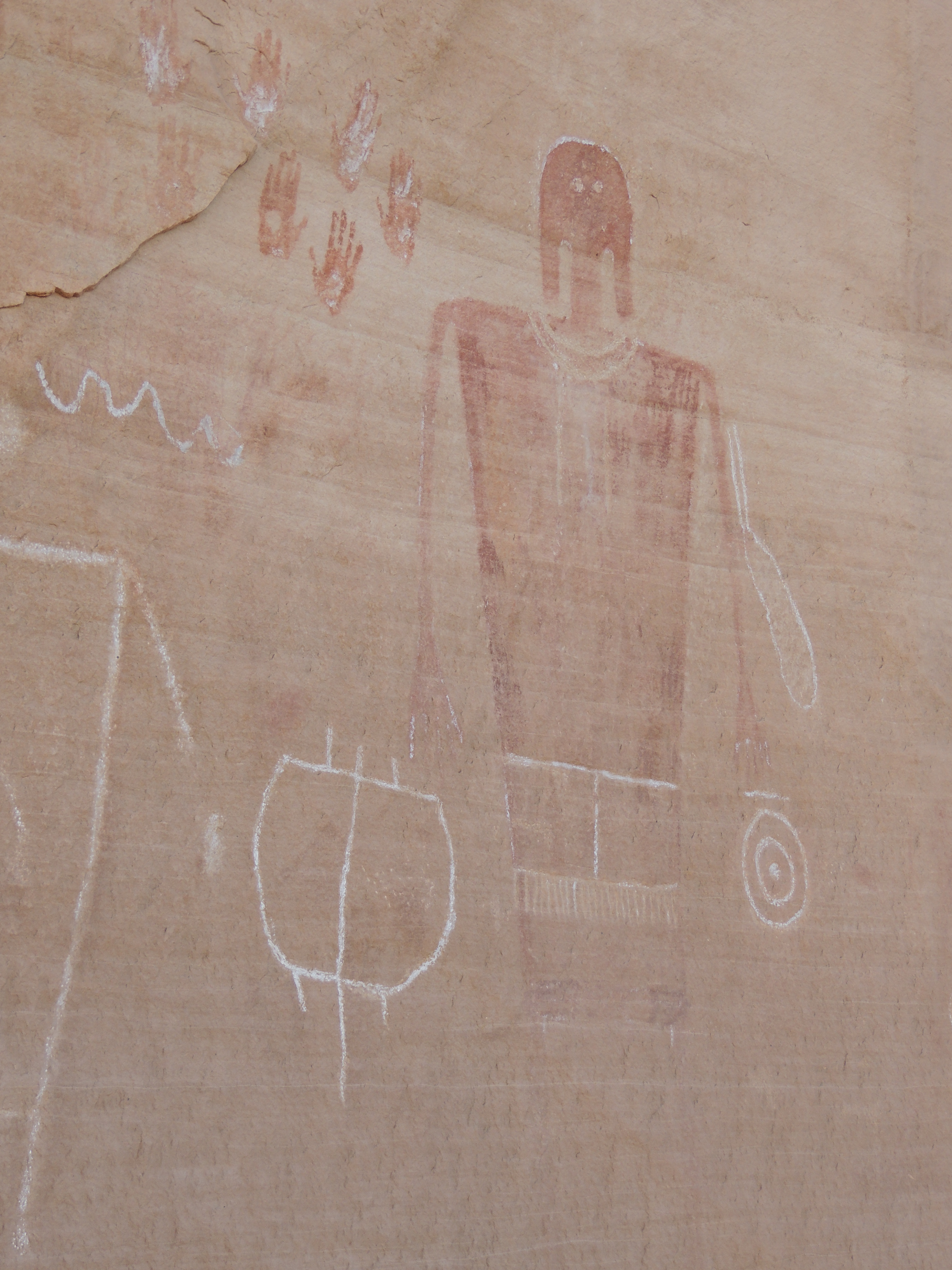
The Big Man Pictograph Panel is of the most evocative panels in Grand Gulch: how can you not look at these huge figures of a man and a woman looking out across the canyon and not imagine the story of their life in this gulch 1200 years ago?

The Government Trail is one of the shortest and easiest access routes into Grand Gulch. The trail crosses the mesa top, and reaches the canyon rim after 2.7 miles, and then it’s just about a 1/2 mile down to the bottom.
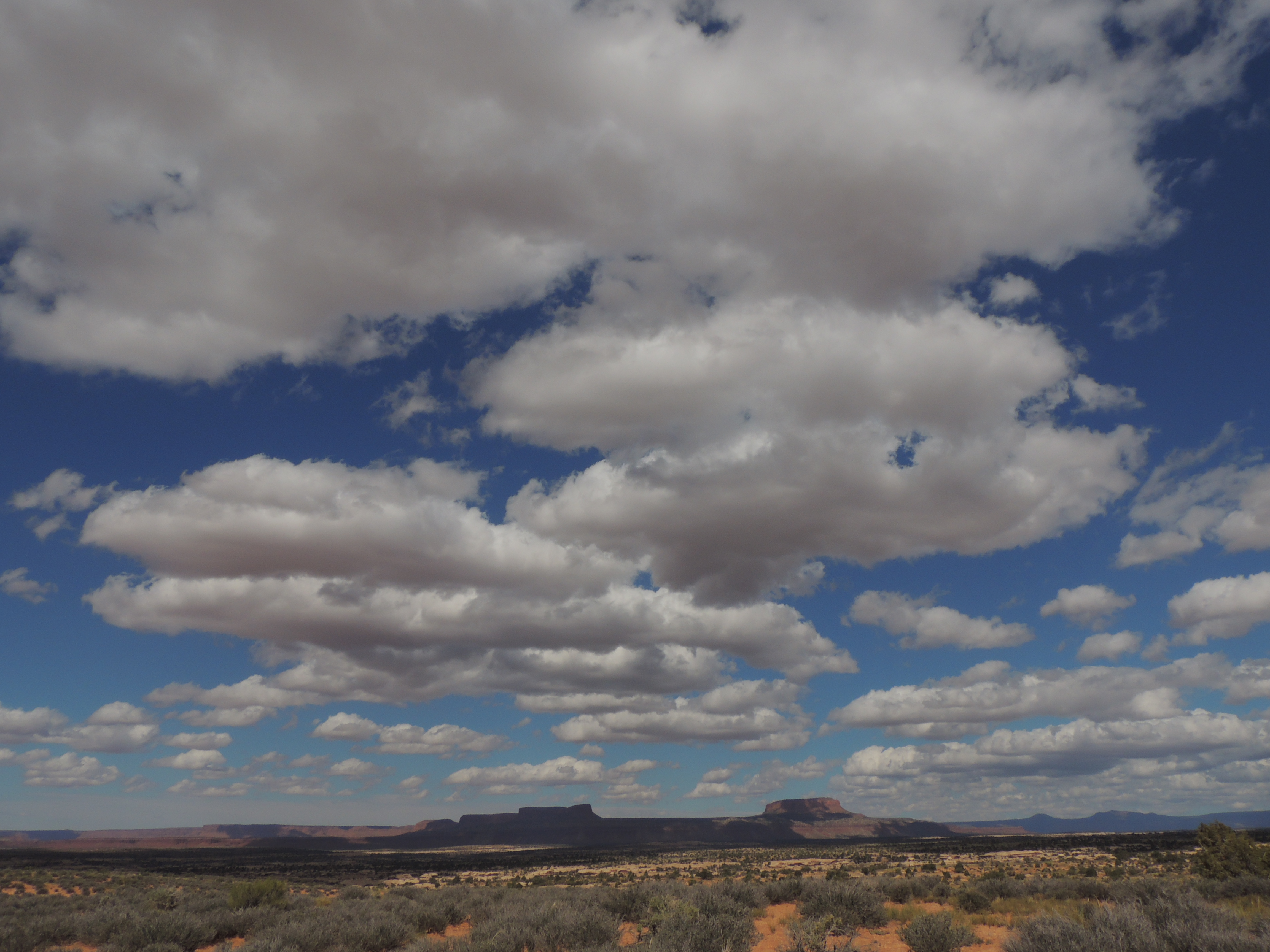
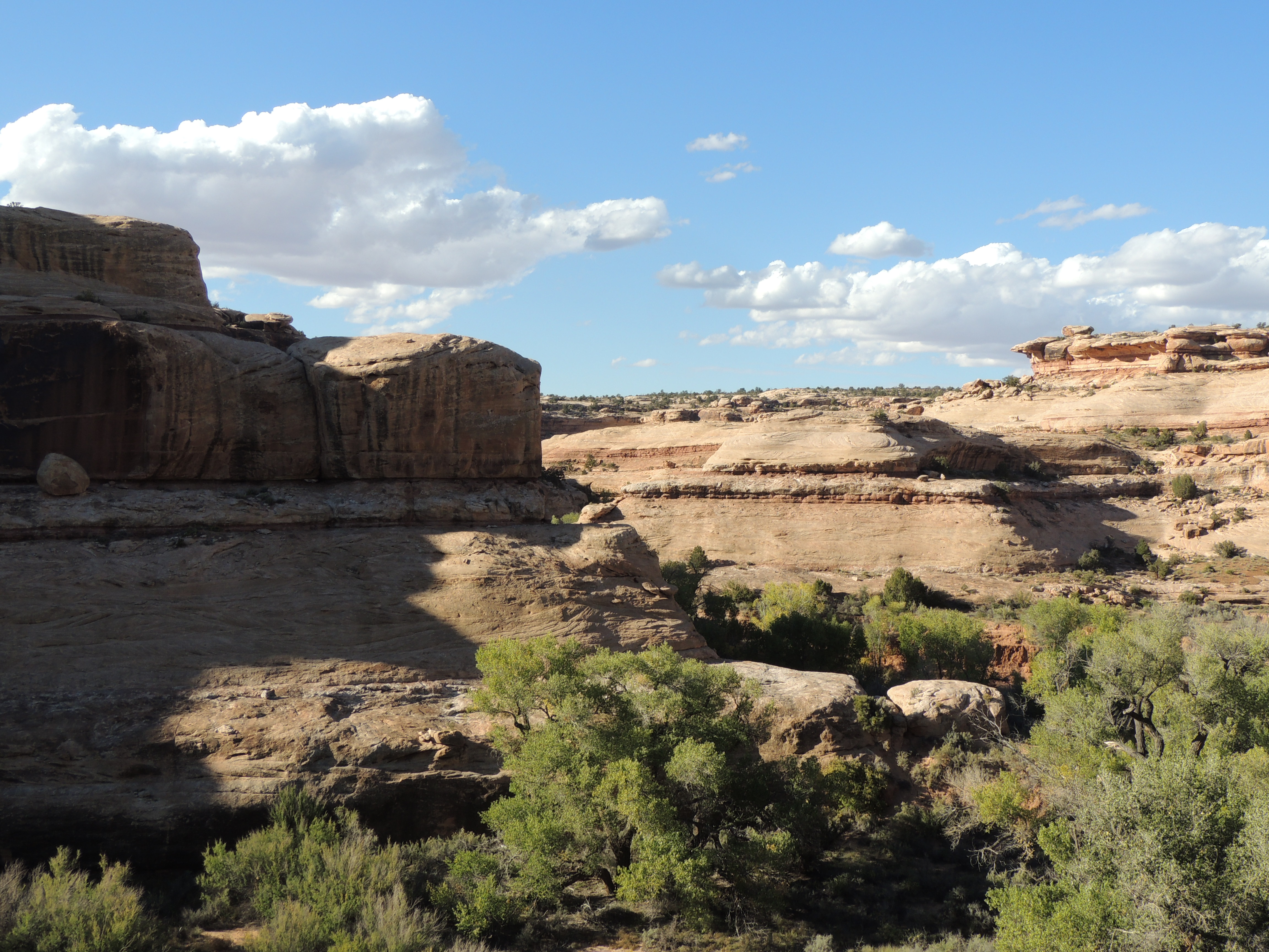
Cedar Mesa is wide open, big sky country, that’s for sure:
We reached the edge of the canyon, and met a couple of hikers on their way out who suggested a good campspot on a ledge about a third of the way down into the gulch. (Incidently, those were the only folks we saw for two days.)

We took their advice, and hiked down, hunting for a good spot to pitch the tent. As we were wandering around we looked up and discovered some faded petroglyphs right above our chosen spot. I love that.


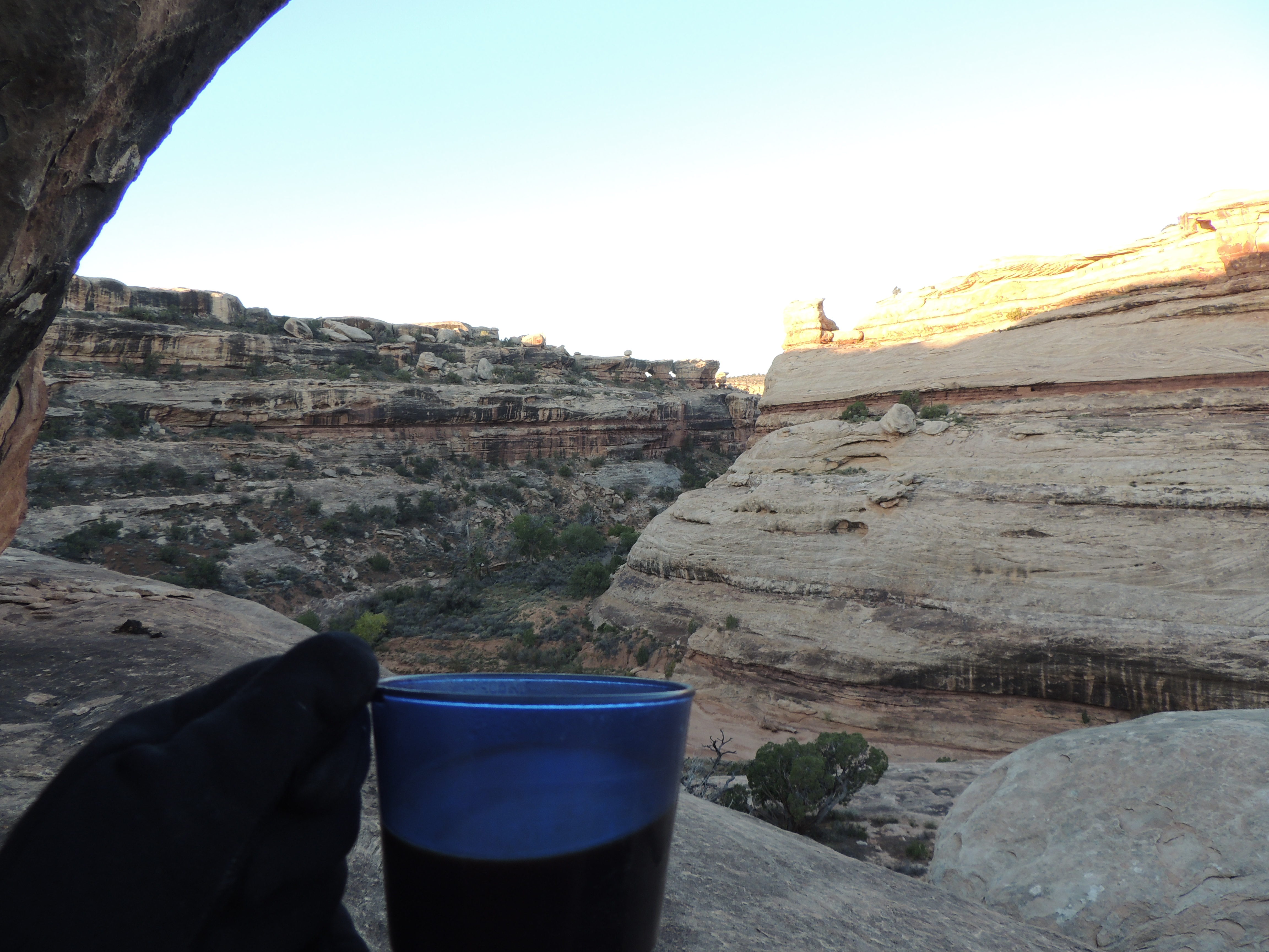
From our campsite we could see a ruin high on the cliff on the other side of the gulch. Like nearly all the dwellings in the area, this one faces south, so it quickly gets the morning sun. The value of this was clear the next morning as I shivered in our shady spot and watched the sun quickly bathe the ruin across the way in warm light.


My coffee helped warm me up, and view was pretty dandy, but man, was it chilly!

But back to the object of our hike: the pictographs. We set up camp and headed up canyon to find them before it got dark. They’re a couple of miles up the canyon from the spot where the Government Trail hits the gulch. The hike itself is grand, along a cottonwood studded creek bottom surrounded by towering red cliffs.

You can’t see the pictographs from the trail, but you’ll see other hikers’ bootprints heading up to the right after a couple of miles. It’s a pretty good scramble to the ledge where the pictographs are, but once you’re there …. wowza.


There’s even an “official” BLM explanation of the panel tucked into an ammo box on the ledge:

Whoever did this wanted to be sure we didn’t miss the genitals. So take note, please.
Here’s the view the big man and woman have been looking at for hundreds of years:

Not too shabby, eh?


What a great camping site. Though staking it down in the rocks might be interesting.
No stakes – just put rocks on the ties and hoped for no big wind!
Glad to see you had coffee on this trip 🙂 and what a spot to drink it! Just lovely!
Ahh, yes…that spot does rate as a great coffee-drinking-spot!
Wow. What a great area. I’m jealous of that campsite.
It was a great campsite – just a little too cold in the morning!
Nice write up and photos. So much to explore out there.
Thanks. I could happily spend a month exploring Grand Gulch, that’s for sure.
Beautiful photos of a beautiful area.
Thanks! It is one of my favorite places in the world.
This landscape reminds me somewhat of the South Dakota Badlands, which I last saw 31 years ago. That sky, oh, how I love that sky. Are these pictographs painted or carved? And into what type of stone?
It is very Badland-ish, for sure. The pictographs are painted, and I think the stone is sandstone. It’s amazing how well-preserved they are. The faint ones that were above our campsite were pecked into the rock. I love that sky as well!
This is a trip I’d like to do…looks like you and Bill had it to yourselves..
You would love it!
Pingback: Another Secret Ruin | Off the Beaten Path: Hikes, Backpacks, and Travels
This looks so amazing, I love seeing ancient rock art, and this is incredibly well preserved…..looking closely at the photos of big man and woman it looks as though there are other faded figures……and the chipped in white marks seem like later additions?
There are some other faded figures next to the big man – I didn’t realize that they showed up in the photo. Good spotting! I think the white marks are from someone “helpfully” outlining the art in chalk. I think it was done many years ago, though, and some of the outlined art is up pretty high, so I’m not sure how they did that. Thanks for looking so closely!